|
| *****SWAAG_ID***** | 52 |
| Date Entered | 11/01/2011 |
| Updated on | 13/12/2011 |
| Recorded by | Tim Laurie |
| Category | Burnt Mound |
| Record Type | Archaeology |
| Site Access | Public Access Land |
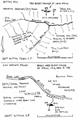
| Location | Witton Fell. Spring rise at small sike on northern side of Sowden Beck. |
| Civil Parish | East Witton |
| Brit. National Grid | SE 1375 8448 |
| Altitude | 308m |
| Record Name | East Witton.Witton Fell. Two Burnt Mound(s) |
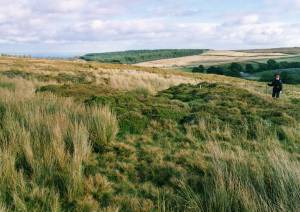
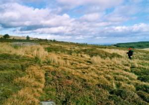
| Record Description | Two large burnt mounds on opposite banks of the stream at the same spring head
Site 1 = Witton Fell Springs Large, high.
Site 2 = Witton Fell Springs Large, average
Both these sites at the same spring rise.
Suitable to visit.
Other evidence for early settlement on Witton Fell includes one or two isolated round cairns and small cairnfield settlements. |
| Additional Notes | Dimensions.
Size: Small <6m, Medium 6m-9m, Large 10m-15m, Extra large >15m.
Height: Low <0.5m, Average 0.5-1.0m, High >1.0m. |
| Image 1 ID | 1691 Click image to enlarge |
| Image 1 Description | Burnt mound , the larger of two adjacent sites at this location. |  |
| Image 2 ID | 1692 Click image to enlarge |
| Image 2 Description | Burnt mound , the larger of two adjacent sites at this location. |  |
| Image 3 ID | 1693 Click image to enlarge |
| Image 3 Description | Location Plan |  |


